Research Trip 2017 - Hobart: A Monument, Land Grants, and Maps
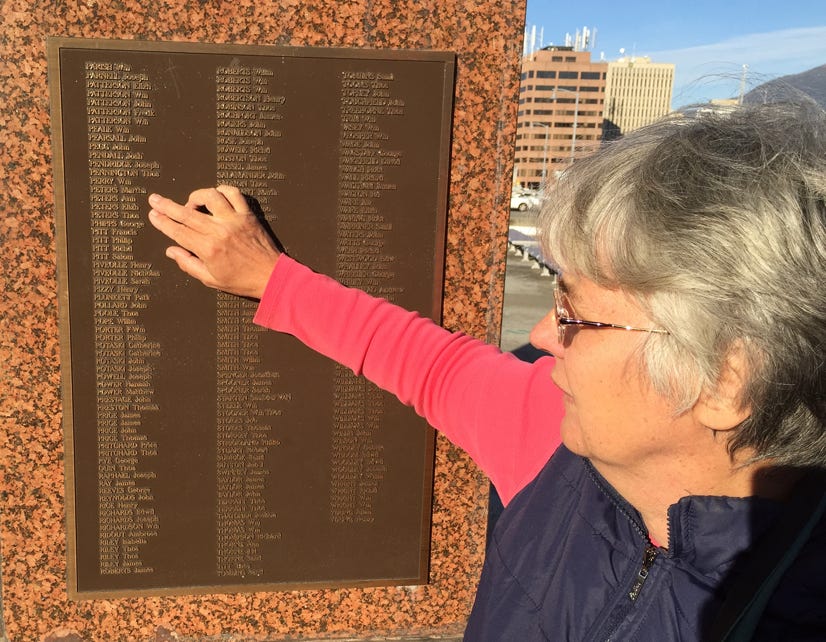
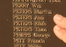
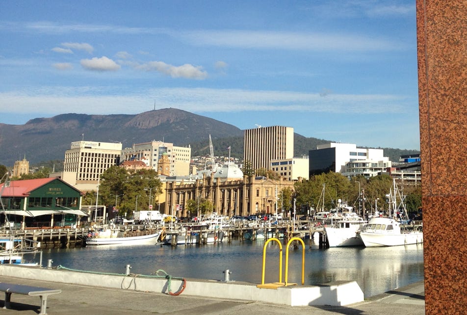
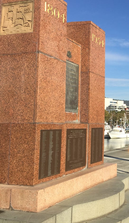
On the 20th of February each year “representatives from the original inhabitants, government, councils, Mission to Seamen, and Historical Societies” attend the tribute at the Hunter Street Monument to commemorate the First and Early settlers. The April time slot of our holidays meant that I was not able to be present with other members of the Hobart Town (1804) First Settlers Association for the 2017 tribute. However I was able to pay a visit to the First Settlers Monument and attend the April monthly meeting.
One of the the pieces of information that I had very much hoped to find while we were in Hobart was the location of the Land Grant made to Mary ‘Ann’ Peters on 18th December 1805. Some married convicts were assigned to their free settler spouses, this was the case for Thomas Peters. The ‘free’ Mary Ann’s presence on the voyage made her eligible for a Land Grant, and the ’Peters farm’ allocated to her would have given the family their start to a new life.
I enlisted the assistance of researcher and author Thelma McKay, and the staff of the State Library of Tasmania to help me to locate the land. Our combined efforts, and my husband’s knowledge of maps and bearings, allowed us to identify the area it was likely to be in. However in the limited time I had we were not able to locate a map that had ‘Peters farm’ clearly marked on it.
In the month prior to our visit I had been in email contact with three very generous members of the Brighton Heritage Association. I met up with Robyn at the First Settlers talk, and on leaving Hobart met with Andrea and Carol at The Brighton Heritage Museum and we looked at more maps! Their hospitality, information and enthusiasm greatly enriched my visit.
On returning home I had the time to do as Carol Brill had strongly encouraged me to do - to continue to really pore over the maps that are available through LINC Tasmania. It was a day of great excitement when I spied “Peters now Preston” on AF396 -1-8 Map - Buckingham 6 . I had finally located the 40 acres that was granted to Mary Peters in 1805.
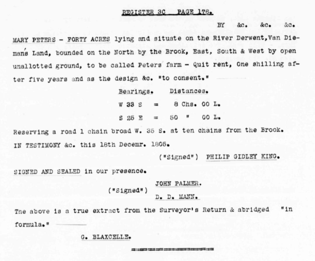
The “Brook” that is referred to in the grant is New Town Rivulet.
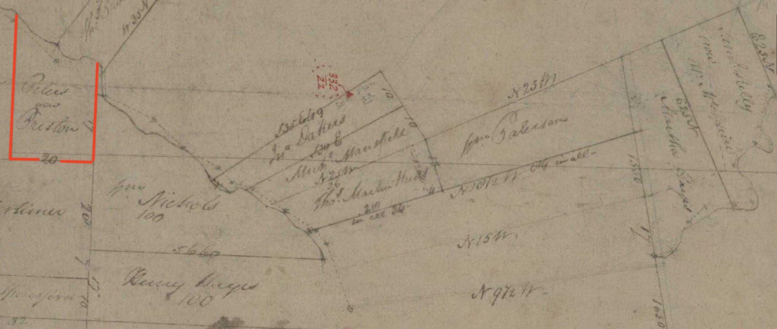
The Peters farm was taken up by Preston, as shown in this image which is detail from: AF396 -1-8 Map - Buckingham 6
The land is marked only as ‘Preston’ on AF396/1/19 Map - Buckingham 17 which was made by surveyor George Babington .
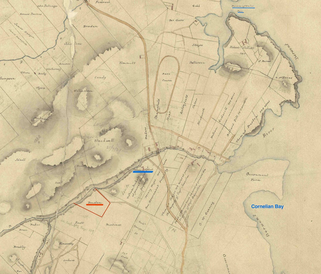
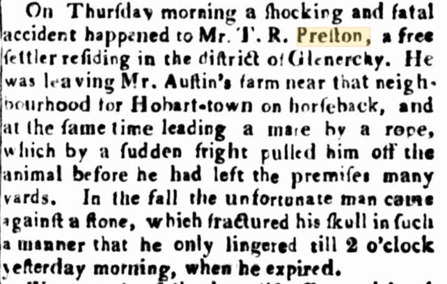
The Hobart Town Gazette and Southern Reporter (Tas. : 1816 - 1821) Sat 11 Jul 1818 Page 2
TROVE - National Library of Australia
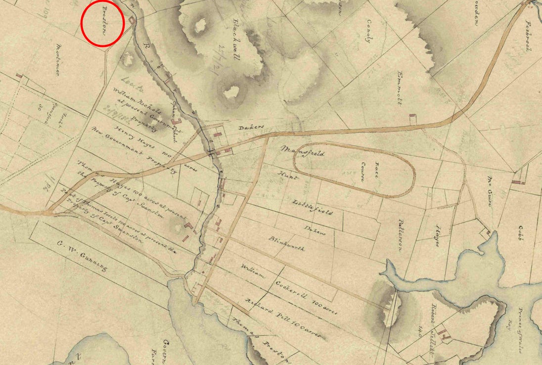
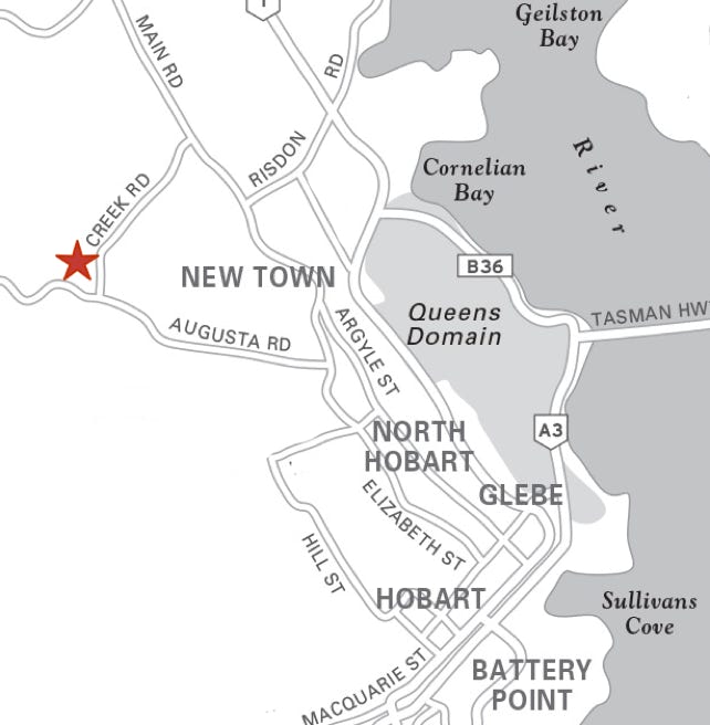
Both the images above show detail from: AF396/1/20 Map - Buckingham 17A - parishes of Hobart and Glenorchy, various landholders - surveyors Babington and Dickson (November 1832)
The Preston land [Red], that had previously been the Peters farm, is shown on this map as being adjacent to the government land which included the orphan school [Blue]. (Thomas Richard Preston died in 1818, so if he was the ‘Preston’ who bought the ‘Peters’ farm it must have been was sold before that date.)
I believe that the Peters farm would have been on, or very close to, the present site of Tasmaid Pura Milk on Lenah Valley Road. (Near John Turnbull Park, Lenah Valley, Hobart.)
RESEARCH Part A.
- RESEARCH - Questions and Inspiration.
- RESEARCH - My curiosity & my many collections.
- RESEARCH - Religion, Politics and the Great Pumpkin
- RESEARCH - The Orange and The Green.
- RESEARCH - Why did they leave? Where did they go?
- RESEARCH - Acknowledgement of Traditional Owners.
- RESEARCH - Stewart and Doody - a puzzling pair.
- RESEARCH - Maps Charts and Trees.
- RESEARCH - Snippets from here and there, and a red herring Z.
- RESEARCH -The 1990 Frazer Reunion, and how we got our Z.
- RESEARCH - Searching for Ships.
- RESEARCH - It’s time to forget about it, or to ‘go it alone’.
- RESEARCH - What, no Glenfiddich or Tullamore Dew?
- RESEARCH - Questions remain: Why did they leave? Was Holt his name?
- RESEARCH TRIP 2016 - They struck out from Sydney.
- RESEARCH TRIP 2016 - He married a Marks.
- RESEARCH TRIP 2016 - They moved on again.
- RESEARCH TRIP 2016 - The Grant/Gorman family of Harden-Murrumburrah
- RESEARCH - Acknowledgement of Traditional Owners.
- RESEARCH TRIP 2016 - An 1874 Tall Ship - The James Craig
- RESEARCH - Could I be right? What do you think?
- RESEARCH TRIP 2017 - The Maritime Museum of Tasmania and the Lady Nelson
- RESEARCH TRIP 2017 - Hobart: A Monument, Land Grants, and Maps.
- RESEARCH TRIP 2017 - Hobart: St David’s Park
- RESEARCH TRIP 2017 - Hobart to York Plains, Home to the Holt and Peters families
- RESEARCH TRIP 2017 - Heading home with questions and a task or two.
- RESEARCH - Plan B - A public website.
- RESEARCH - Choose your own adventure

